Support this map project
Donate to the project
If the Freizeitkarte project does something good for you maybe you can think about supporting us a little. Regard this as an invitation to "a cup of tea and a piece of cake".
Donation option by transfer to a German bank account
Account holder: Klaus Tockloth
Bank: Volksbank Münster eG
BIC: GENODEM1MSC
IBAN: DE48401600501701199600
Donation option by transfer via PayPal
Thanks for your support - you are helping us to continue the project.
The following people are actively working on the Freizeitkarte project:
- Patrik Brunner (development, server administration)
- Jens Gruhlke (build management, server administration)
- Christian Kraemer (build management, server administration)
- Klaus Tockloth (development, design freizeitkarte)
- Alumni: Stephan Brugger
Hint for program/app developers
All maps and themes are also listed in a repository file. This repo can be used to integrate downloads directly into the app.
Link: XML-Repository
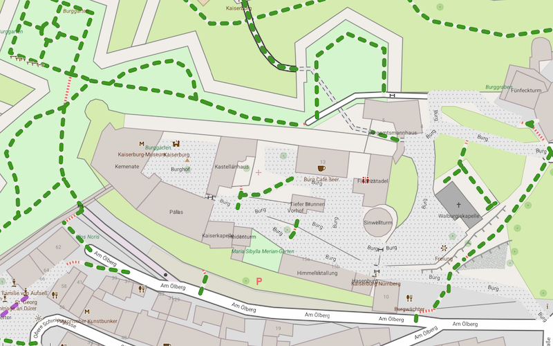
Germany, Nuremberg, many details about the Imperial Castle (design freizeitkarte)
Statement according to section 5 of the Telemediengesetz (TMG)
Klaus Tockloth, Im Seihof 34
D-48161 Münster, Germany
eMail: freizeitkarte@googlemail.com
Further project
Link: Maps for Garmin-GPS-Devices
Disclaimer / Notice of liability for links / Privacy protection policy / Copyright
Due to German regulations this part of the 'about section' is very special and only available in german.
Link: German 'Impressum'
DSGVO
These websites do not collect, store or process any personal data.
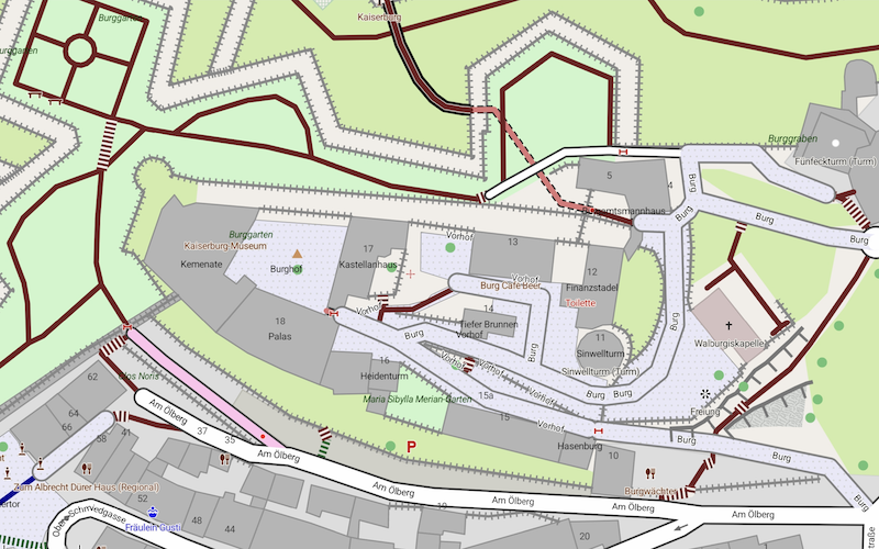
Germany, Nuremberg, many details about the Imperial Castle (design fzk-outdoor-contrast)
Use of the maps
The use of maps is at your own risk. The map data and / or the routing may contain errors or may be insufficient. The creators of these maps are not liable for any damage resulting
directly or indirectly from the use of the maps.
License conditions of the map data
Map data © OpenStreetMap contributors (ODbL). All maps are based on data from the OpenStreetMap project. OpenStreetMap is a free editable map of the whole world that is created by people
like you. OpenStreetMap allows you to view and collaboratively edit geographic data from anywhere in the world.
Link: www.openstreetmap.org/
License: www.openstreetmap.org/copyright/en
License conditions of the elevation data
The contour lines are based on different sources, depending on availability.
Data provider name: Various (compiled by Sonny)
Data provider homepage: sonny.4lima.de/
License type: CC BY 4.0
License string: sonny.4lima.de - SONNY's LiDAR DIGITAL TERRAIN MODELS (DTM) OF EUROPEAN COUNTRIES, CC BY 4.0
Data provider name: U.S. Geological Survey
Data provider homepage: usgs.gov/centers/eros
License type: Public Domain
License string: U.S. Geological Survey (public domain), eros.usgs.gov
Data provider name: JAXA (Japan Aerospace Exploration Agency)
Data provider homepage: earth.jaxa.jp/en/
License type: CC BY 4.0
License string: AW3D30 - JAXA (Japan Aerospace Exploration Agency), CC BY 4.0
License conditions of the maps
Produced map © FZK project. The available maps are a derived work from map and elevation data. The maps can be used free for any purposes.
Provision of OpenStreetMap data
Daily updated country- and region-specific extracts of the OSM database data are provided by the company Geofabrik GmbH (Karlsruhe, Germany).
Link: www.geofabrik.de
Creation of the maps
All maps were created using the tools "osmfilter, osmconvert" and "Mapsforge MapWriter".
Link: wiki.openstreetmap.org/wiki/Osmfilter
Link: wiki.openstreetmap.org/wiki/Osmconvert
Link: github.com/mapsforge/mapsforge
License: 100% free and open source (LGPL3 license)
Creation of the contour lines
The contour lines were created using the tool "phyghtmap".
Link: github.com/agrenott/pyhgtmap
License: GPL-2.0 license
Trademarks
Mac OS® is a registered trademark of Apple Inc. (www.apple.com).
Windows® is a registered trademark of Microsoft Corp. (www.microsoft.com).
Picture credits
The overview and relief maps are created with QGIS and are based on data from "Natural Earth" (www.naturalearthdata.com).
Android apps
The apps "Locus Map Free" and "Locus Map Pro" are programs by Asamm Software, s. r. o., Prag (www.locusmap.eu).
The apps "OruxMaps" and "OruxMaps Donate" are programs from Jose Vasquez, Madrid (www.oruxmaps.com).